Put down the books and hit the coast: A Weekend Guide to the Light to Light Walk (Yuin Country)

Feeling the grind of study? It's time to swap the library for some of the most stunning coastline NSW has to offer. Just a few hours' drive from the capital, the Light to Light walk is the perfect weekend escape to recharge your batteries, soak in some nature and create some epic memories with your mates.
The Ultimate Coastal Adventure
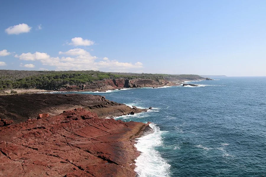
Stretching for 30 glorious kilometres along the Sapphire Coast, the Light to Light Walk is a journey through ancient forests, across dramatic red-rock cliffs and alongside pristine, secluded beaches. This three-day hike is your ticket to a world away from deadlines and lectures.
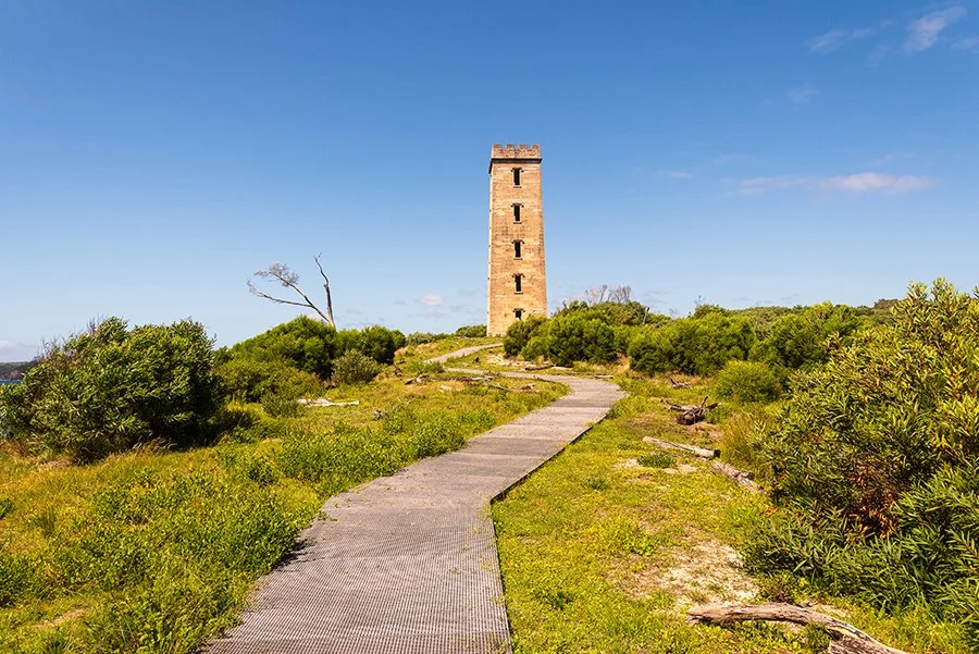
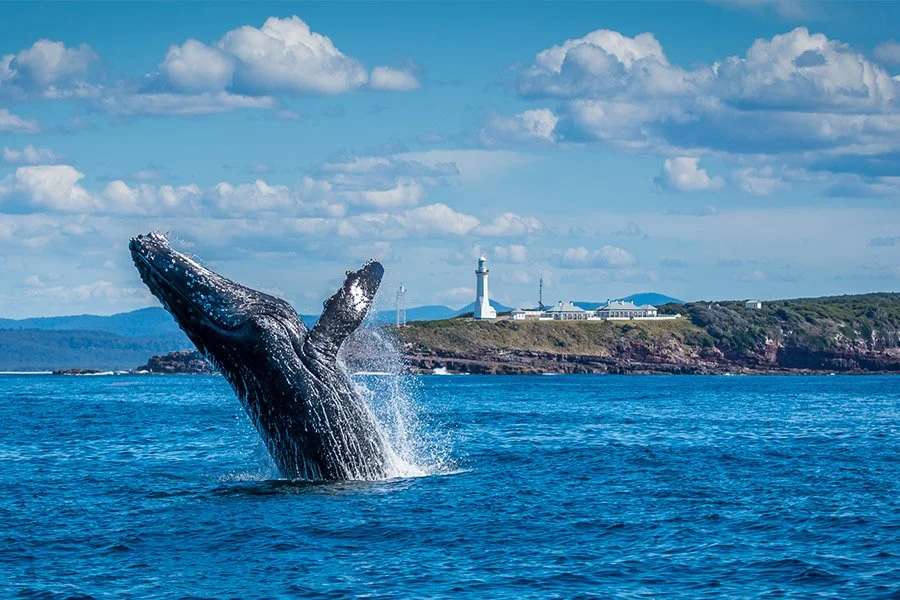
Starting at the historic Boyds Tower and finishing at the iconic Green Cape Lighthouse, you'll be treated to a constantly changing landscape. Think tea tree groves, banksia woodlands and sheltered coves perfect for a mid-hike dip. And let's not forget the wildlife! Keep your eyes peeled for seals lounging on the rocks, majestic seabirds and if you're there between September and November, the incredible sight of migrating humpback whales!
Make it Happen
If you’re an experienced walker and comfortable carrying your own pack and supplies, you can tackle the walk self-guided and book to stay each night at the 2 hike-in campgrounds.
⏱️ 3 days - 2 nights
🧭 32km, Grade 4 - Bushwalking experience recommended
🏕️ Camp on hardwood platforms at Mowarry Point and Hegartys Bay. Platform size is 5.4 x 3.6m
💵 $115 for 2 nights camping. Pricing is per campsite which can fit 1 to 2 hikers’ tents. Excludes transfers. Book a single or return transfer with Navigate Expeditions.
Recommended Itinerary
Day 1: Boyds Tower to Mowarry Point (9km)
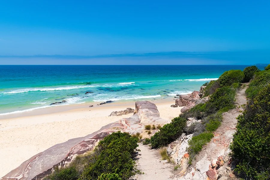
Your journey begins at the historic Boyds Tower, the gateway to Beowa National Park. Immerse yourself in a landscape rich with cultural significance, where striking red sandstone cliffs meet brilliant turquoise waters. The track meanders through fragrant tea tree forests, leading to the secluded shores of Leather Jacket Bay or Mowarry Beach for a refreshing swim. Settle in for the night at the peaceful Mowarry campground, nestled just behind the headland.
Day 2: Mowarry Point to Hegartys Bay (10km)
Today’s path unfolds through a stunning mosaic of coastal heath, pristine beaches, and dramatic ocean rock platforms. As you hike, keep your eyes on the horizon for migrating whales and to the skies for majestic sea eagles. The day's journey concludes at the sheltered Hegartys Bay campground, your secluded coastal haven for the night.
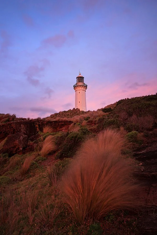
Day 3: Hegartys Bay to Green Cape Lighthouse (13km)
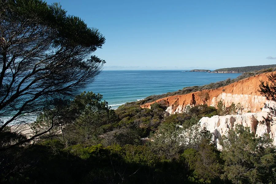
Prepare for a day of dramatic grandeur, defined by immense cliffs and expansive skies. Feel the power of the coast as you listen to waves crashing into the rocks below. Find a moment of tranquility with a swim in the calm, protected waters of Bittangabee Bay, then gaze back on your progress from the breathtaking Pulpit Rock lookout. The final, rewarding stretch leads you to your destination: the iconic Green Cape Lighthouse.
Campsites
Night 1: Mowarry campground
10 hardwood platforms
Rainwater tank (treat before drinking)
Non-flush toilets
Pack guy ropes to fix you tent to the platform
Night 2:
Best remote camping in all of Beowa!
10 hardwood platforms
Rainwater tank (treat before drinking)
Non-flush toilets
Pack guy ropes to fix you tent to the platform
Is this walk right for you?
The 32km Light to Light Walk is a spectacular one-way coastal journey. While rated as Grade 4, the track is well-marked and relatively flat, making it an excellent choice for those new to multi-day hiking.
The path itself is easy to follow; simply look for the distinctive ‘Light to Light whale’ markers that guide you along a variety of terrains. You will traverse forest tracks, sandy beaches, and rock platforms. Be prepared for some sections that cross cobbled beaches, slippery rock platforms, and shallow creeks.
Designed to be enjoyed at a comfortable pace, you can expect to walk for 2 to 5 hours each day. This leaves plenty of time to stop for lunch with a view and immerse yourself in the scenery. However, while the trail is accessible, self-sufficiency is key. The remote location is part of its charm, but it means you must have some bushwalking experience and be prepared to carry all your camping gear, food, and supplies, as you won't pass any towns or shops.
Getting there, parking and road access
Due to the remote location, leaving vehicles unattended overnight carries security risks. We strongly recommend booking a shuttle service (such as Navigate Expeditions) or arranging for someone to drop you off and pick you up.
What to bring
As this is a 3-day self-guided walk, you must be fully self-sufficient. Pack carefully for varied terrain and potential exposure to the elements. Here is packing checklist:
Backpack & Storage:
Waterproof backpack with a capacity of approximately 50 litres.
Dry bag or internal pack liner to keep essential gear dry.
Tent suitable for hiking.
Guy ropes are essential for securing your tent to the hardwood platforms.
All other necessary camping equipment (sleeping bag, mat, etc.).
Sufficient food for 3 days and 2 nights.
Fuel stove, fuel, and cooking utensils.
Warm layers (e.g., fleece, thermals).
Wet weather gear (waterproof jacket and pants).
First-aid kit.
Emergency communication device (e.g., Personal Locator Beacon - PLB).
Navigation tools (map, compass, or GPS device).
Water Supply: A Critical Guide
Water availability along the track is limited and requires careful management.
Carry: You must bring containers and be prepared to carry at least 5 litres of water for drinking and cooking.
Refill Points:
Mowarry (Night 1) & Hegartys (Night 2) Campgrounds: These sites have small water tanks, but their supply is not reliable. Do not depend solely on them.
Saltwater Creek & Bittangabee Campgrounds: You will pass these sites on Days 2 and 3. They have more reliable supplies of tank water and are good opportunities to refill.
⚠️ You must treat all water collected from tanks before drinking. Untreated water may be unsafe. Use one of the following methods:
Boil water for at least 5 minutes.
Use a high-quality water filter.
Use water treatment tablets or a UV treatment device.
Trail Safety and Hazard Awareness
Your safety is your responsibility. This trail includes specific coastal hazards that require careful planning and constant vigilance.
Navigating Rock Platforms and Cliffs
This is the most technically challenging aspect of the walk and requires careful planning.
Plan Around Tides and Swells:
Check tide charts before your trip. You must plan to cross rock platforms only at low tide.
Check the swell forecast. Avoid walking during periods of high swells or rough seas, as waves can sweep over platforms unexpectedly.
If conditions are rough on Day 3, do not attempt the coastal route. Instead, use the safer, well-marked inland track from Bittangabee Campground to Green Cape Lighthouse.
On the Trail:
Watch your step at all times on uneven and slippery surfaces.
Stay well back from cliff edges and be constantly aware of wave conditions.
Always supervise children closely in these areas.
Beach and Ocean Safety
Unpatrolled Beaches: No beaches in Beowa National Park are patrolled by lifeguards. You swim at your own risk.
Rip Currents: Dangerous rip currents can be present on all beaches, even when the water appears calm.
Swimming: While the bays at Mowarry and Bittangabee are somewhat sheltered, exercise extreme caution if you choose to swim.
Creek Crossings
You will need to cross several creeks, including Saltwater, Woodburn, and Bittangabee Creeks.
Water levels can change rapidly due to tides, high swells, or recent rain.
Always assess the depth and current before attempting to cross. Do not cross if the creek is flooded.
Emergency Preparedness and Communication
Expect limited to no mobile phone service in this remote location. You cannot rely on your phone to call for help. Download the Emergency Plus app to your phone before you leave home. It can provide emergency services with your precise GPS location, even without signal. Finally, carry a well-stocked first-aid kit and consider taking a Personal Locator Beacon (PLB) for emergencies.